for the Siskiyou Hiker
by Gabriel Howe
It turns out the Boundary Trail isn’t a boundary at all. It’s a connection, and part of the Bigfoot Trail.
14 JULY 2017 | RED BUTTES WILDERNESS, ORE. — Probably over a decade ago, the Klamath National Forest’s Boundary Trail began to fill in with brush. The National Recreation Trail running along the Red Buttes Wilderness’s boundary grew over and grew impassable.
[peg-image src=”https://lh3.googleusercontent.com/-a2MLceeei_M/WWgUApi7MkI/AAAAAAAAVrI/v5JCUURd5TkD8vE9x5yZhK4Q2W7zn9S8wCCoYBhgL/s144-o/SAM_4930.JPG” href=”https://picasaweb.google.com/106889352618986621551/6387744301771775825#6442421268338389570″ caption=”” type=”image” alt=”SAM_4930.JPG” image_size=”4608×3456″ ]Jeff Ellison, one of the masterminds behind the project
Jurisdictional labyrinth
The Red Buttes Wilderness is managed by the Rogue River-Siskiyou National Forest. Klamath National Forest manages the Boundary Trail, which exists barely outside but running right along the Red Buttes Wilderness’s southern boundary, dividing the Rogue and Klamath watersheds.
[peg-image src=”https://lh3.googleusercontent.com/-XBUnUQ9hz30/WWgUAnLBabI/AAAAAAAAVsk/cEjtVGyfCawuWFU5Y3xsXGJqBkGZqk1YACCoYBhgL/s144-o/SAM_4962.JPG” href=”https://picasaweb.google.com/106889352618986621551/6387744301771775825#6442421267701262770″ caption=”” type=”image” alt=”SAM_4962.JPG” image_size=”4608×3456″ ]Ancient cedar in the Red Buttes
Last year, we opened up a labyrinth of trails that had faded from the Red Buttes, and the Boundary Trail had become a missing link between the Red Buttes and Grayback Ranges with the Pacific Crest Trail, representing an impenetrable choke hold between this pocket of the high Siskiyous and the rest of the Pacific Coast.
Last year a group of us had identified that gap and decided to do something about it.
Meeting of the minds
“It started with a meeting of the minds in Happy Camp last November, which included representatives from neighboring Districts, Forests, and trail organizations.” says Jeff Ellison, Recreation Officer for the Klamath National Forest’s Happy Camp Ranger District.
[peg-image src=”https://lh3.googleusercontent.com/-cJPpJpLbuzs/WWgUApA6zTI/AAAAAAAAVqo/FcDaTBDwnhQ50QFdAKmjrCz_HNAELXZ1QCCoYBhgL/s144-o/SAM_4910.JPG” href=”https://picasaweb.google.com/106889352618986621551/6387744301771775825#6442421268195757362″ caption=”” type=”image” alt=”SAM_4910.JPG” image_size=”4608×3456″ ]Valentin Chavez and his crew
Breaking boundaries to save the Boundary Trail
In the interim, the Rogue River-Siskiyou National Forest saw the potential in the project and set us up with an agreement to work on the Klamath side. That’s pretty unorthodox. And it’s smart, because it benefits both the Klamath and Rogue side of things.
[peg-image src=”https://lh3.googleusercontent.com/-O6hAHUGMwDw/WWgUAle-R9I/AAAAAAAAVqw/Wx0zdMZh_YgnBgqIyFO5q7zA6kRFqv0vQCCoYBhgL/s144-o/SAM_4921.JPG” href=”https://picasaweb.google.com/106889352618986621551/6387744301771775825#6442421267248072658″ caption=”” type=”image” alt=”SAM_4921.JPG” image_size=”4608×3456″ ]Gabe Howe and Jeff Ellison
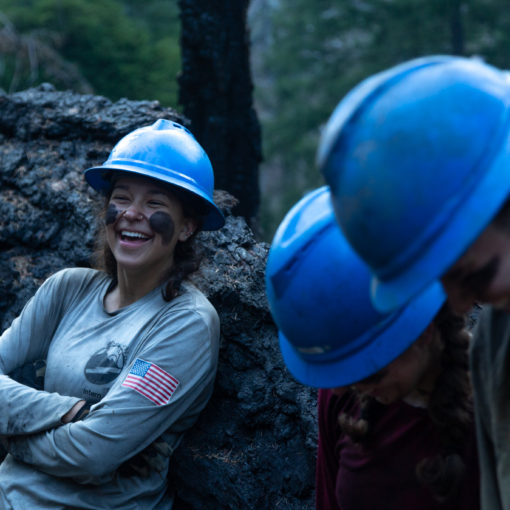
Our interns started working the trail on July 3. The next week, the Klamath National Forest’s trail crew started working from Cook and Green Pass, and the crews met up on July 11 for a “golden spike” moment.
The golden spike
“We had a handshake along the trail,” says Ellison. “It marked the emergence of a loop that crosses boundaries, a level of integration we can all be proud of.”
SMC Crew Chavez had the chance to campout with the Klamath crew at Kangaroo Springs before heading back on Wednesday, July 12.
[peg-image src=”https://lh3.googleusercontent.com/-ygToQhvVZek/WWgUArPWsYI/AAAAAAAAVsY/jNtSTg73XOgz5fclB7qRIVvIZcM9ZalmACCoYBhgL/s144-o/SAM_4967.JPG” href=”https://picasaweb.google.com/106889352618986621551/6387744301771775825#6442421268793176450″ caption=”” type=”image” alt=”SAM_4967.JPG” image_size=”4608×3456″ ]Valentin Chavez and Nick Hodges reading their maps
On the crew’s way back into town, Crew Chavez met with with Donna Mickley, District Ranger for the Siskiyou Mountains. She manages the Rogue-Siskiyou’s side of this new trail complex.
[peg-image src=”https://lh3.googleusercontent.com/-xtPvF1r3EMY/WWgUAplcL5I/AAAAAAAAVq4/DSHQApxLZe0Z_rYOKUfap3NFNgmd2GXwwCCoYBhgL/s144-o/SAM_4926.JPG” href=”https://picasaweb.google.com/106889352618986621551/6387744301771775825#6442421268348940178″ caption=”” type=”image” alt=”SAM_4926.JPG” image_size=”4608×3456″ ]Klamath National Forest and Siskiyou Mountain Club crews at the “Golden Spike”
John McKelligot, a Forest Service employee on the Rogue-Siskiyou, has been working the area since 1987. “Thank you guys. The buttes are near to my heart,” he says.
Mickley reverberated McKelligot, and they were all smiles. “Thank you so much,” said Mickley. “You guys are great.”
This boundary connects
The Boundary Trail connected Mickley’s trail system to a whole new world for long distance hikers and weekend backpackers. They could start from the Oregon Caves National Monument, the Applegate, Sucker Gap, or somewhere else in the Siskiyou range, and hike from there to anywhere between Canada and Mexico.
[peg-image src=”https://lh3.googleusercontent.com/-bK9yOGpN4Cw/WWgUAirCX4I/AAAAAAAAVs0/-CaKvy_TtxMxDo0WfToig7ui2mktFEP2QCCoYBhgL/s144-o/SAM_4943.JPG” href=”https://picasaweb.google.com/106889352618986621551/6387744301771775825#6442421266493366146″ caption=”” type=”image” alt=”SAM_4943.JPG” image_size=”4608×3456″ ]Karly White
Not before last week.
So, it turns out the Boundary Trail isn’t a boundary at all. It’s a connection. And it’s nice to be in the business of building connections, not walls. ###
Gabriel Howe is executive director of the Siskiyou Mountain Club. When he’s not working, you could find him with his family or swimming laps at the Y.


