
Bye, bye Kalmiopsis brush wall
Hello, Kalmiopsis Rim Trail 1124
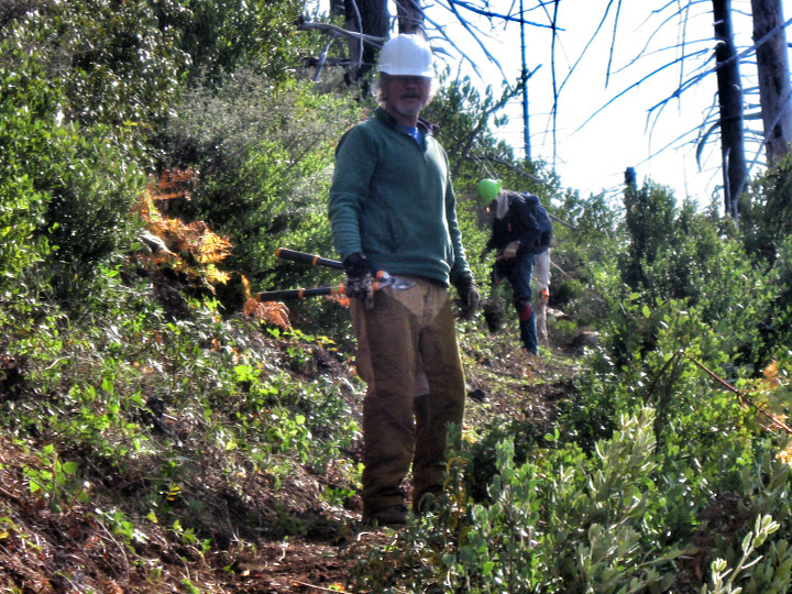
26 October 2015 | Onion Camp: Kalmiopsis Wilderness, OR — Last Thursday, October 22 a group of SMC volunteers didn’t waste any time when they got to the Onion Camp Trailhead at 9:15am.
The hike started with a steep ascent through a savanna to a serpentine saddle under Whetstone Butte. From there the trail heads to the butte’s southwest slope. The wind whipped and whistled through skeleton forests, then calmed down as we reached the southwest aspect of Whetstone.
These true soils once supported a strong conifer forest, but since the forest burned in 2002, the soils are sustaining a massive canker of brush that had swallowed whole this section of the Kalmiopsis Rim Trail 1124. It didn’t take us long to get to the brush wall we left on October 11. 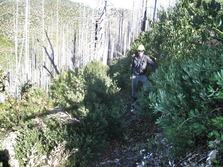
We clipped away at the mountain whitethorn, canyon live oak, tanoak and other shrubs…
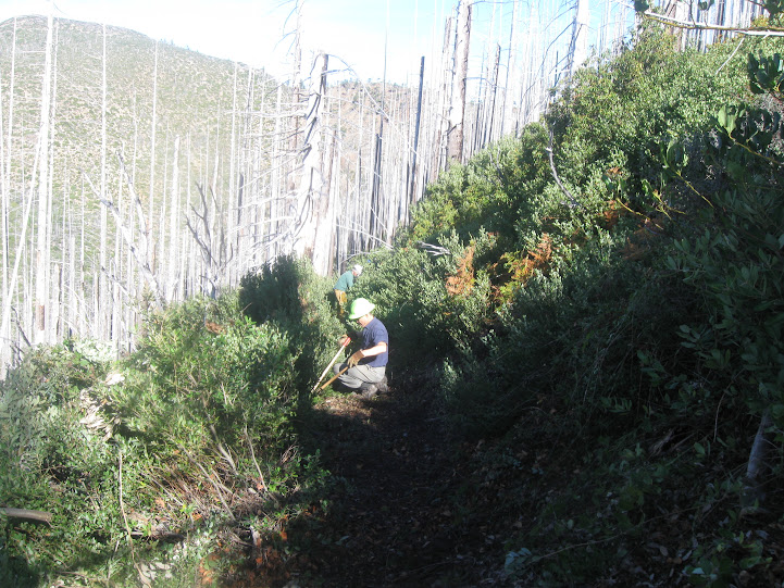
After clipping away all day..
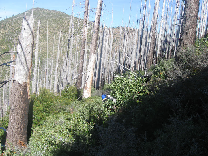
the crew broke through to Eagle Gap:
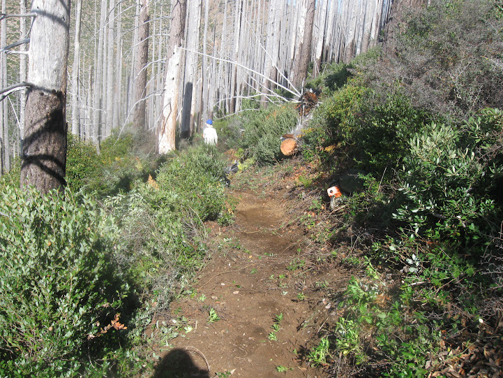
We also cut over 25 logs that were down on the trail.
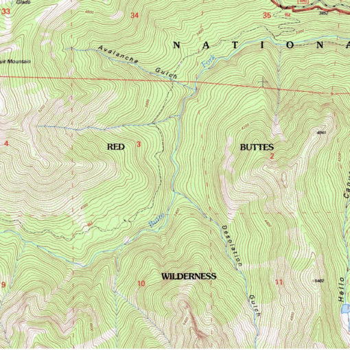
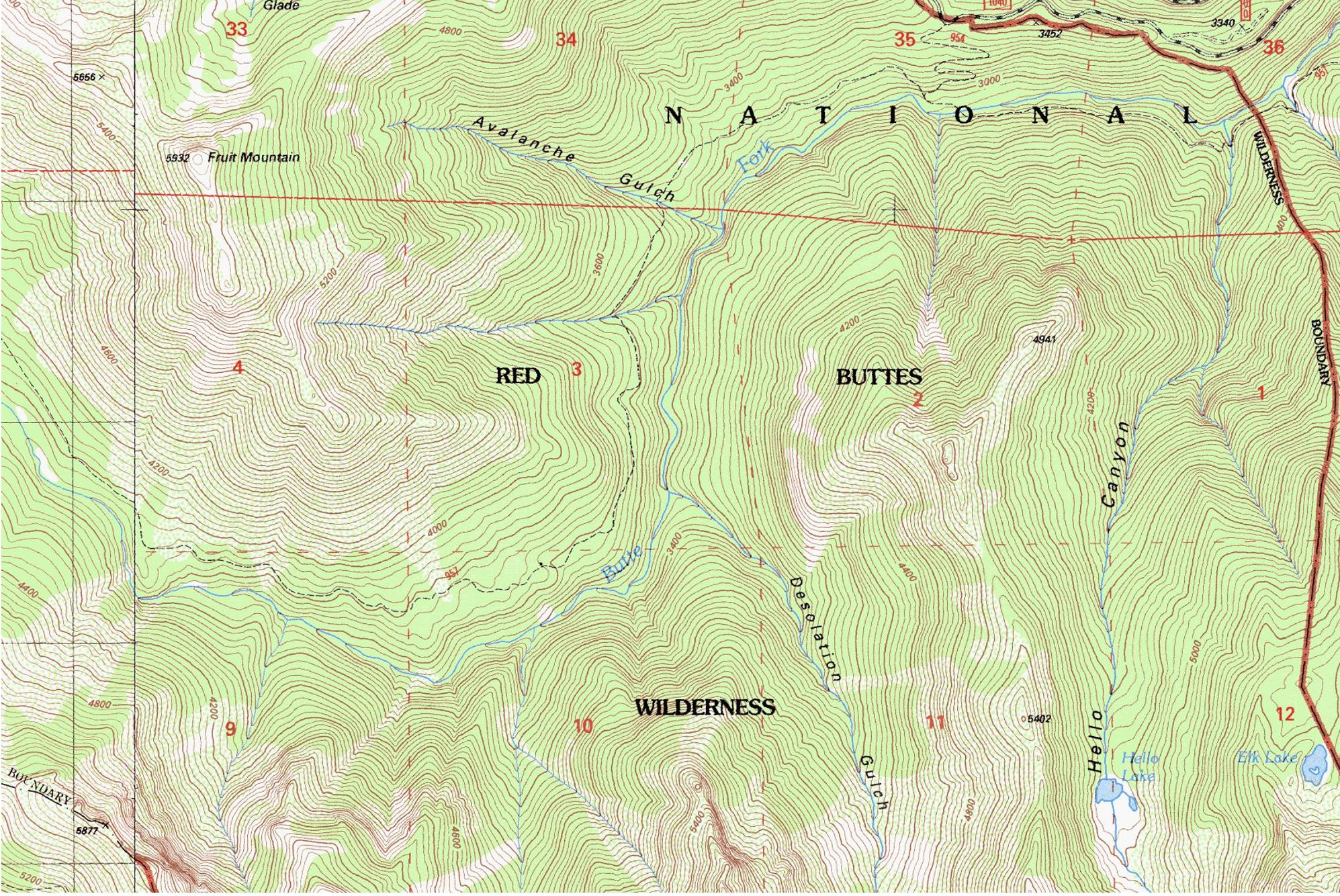
The Kalmiopsis Rim Trail 1124 serves as an artery to a number of other trail routes. The trail runs 34 miles from Mount Billingslea on its north end, south all the way to the terminus of Forest Service Road 112 accessed from O’Brien, OR. We’ve restored about 1/2 of the trail, but long sections of it are still in disrepair.
The Kalmiopsis Rim Trail has multiple access points. The easiest is from Onion Camp, where you can head north toward Chetco Pass and Pearsoll Peak, or south toward Babyfoot Lake and onto the Trans-Kalmiopsis Route.
Get started with the Wild Rivers District Map from Medford’s BLM/USFS office (3040 Biddle Road) or Medford REI (95 Rossanley Drive). From Redwood Highway 199 in Kerby, OR head west on Eight Dollar Mountain Road, take out the map, and follow Forest Service Road 4201 all the way to Onion Camp.
