13 NOVEMBER 2020 | GRANTS PASS, OR. — Finally, the weather has turned for the better, potentially pulling us from a historic drought, for now at least. And while we are celebrating the positive news for our water tables and snow pack, it also has us rummaging around for suitable hikes before we dust off the snow gear. First, some tips.
Get ready
Hiking and backpacking in the rain doesn’t have to be miserable. And for some, super high-quality rain gear is an economic option. For others, it isn’t, and we’ve found that at the end of the day, no matter your budget, you’re going to get wet. So ditch the cotton and go with high-quality wool for your layers. Also, there’s no shame hiking in an umbrella.
Watch the weather carefully
Remember when the forecast was static for…months? “A ridge continues to hold over the Northwest with no end in sight.” Well, the new discussions are a lot more animated, and if you read between the lines, you may be able to find short breaks in the weather. Often times weather systems are like pulses, and reading the full forecast discussions can give you insight into when and even what time of day to go. Also, the hourly weather forecast is worth a look. All can be found at weather.gov, which is the only forecast service we rely on at SMC.
Now, a few hikes for cold, wet weather:
Frances Shrader Old-Growth Trail #1172: For the whole family
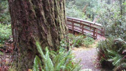
This loop-trail just miles from Gold Beach harbors some of the best old growth on the west coast. Larger-than-life Douglas firs tower hundreds of feet into the canopy, and fairy-tale myrtle and tanoak rise to the forest ceiling. Pick up the Gold Beach Ranger District map and from Gold Beach, take Jerry’s Flat Road up the Rogue River for about 10 miles. Head south on Forest Service Road 090 for a couple of miles to the trailhead.
South Fork Kelsey Trail: As far as you’d like
Tucked just inland of the Northern California Coast, the South Fork of the Smith River is sure to catch lots of rain each year. But the first miles of the South Fork Kelsey Trail that traverse its banks are low enough in elevation that they remain available all year. And you might be surprised at just how clear the South Fork Smith runs, with its headwaters protected by the Siskiyou Wilderness, even in the biggest of storms.
The trail features some of the most amazing old growth stands left on the West Coast. And depending on your appetite, you can hike it for a few miles, or far into the Siskiyou Wilderness Area. Crossing Harrington and Eight Mile Creeks could be dangerous depending on water levels.
Middle Fork-Applegate Trail: Rogue Valley refuge
This National Recreation Trail leads from the Middle Fork Applegate River all the way to the Frog Pond Trail, but there is a stream crossing about a mile up from the trailhead that may be difficult to navigate during winter months. That hike by itself is worth it as it skirts along steep banks and old growth forests.  This section of the river is nice, too, and might be somewhere to remember for the summer months when you need some shade and some swimming holes. It’s about forty minutes from Ruch, OR.
- Pick up the Red Buttes Wilderness Map
- Mail Tribune story about Middle Fork Trail
- Forest Service website
Rogue River Trail: Winter backpacker’s delight
This 40-mile National Recreation Trail is a nightmare in the summer. Hoards of hikers crowd into the canyon, and it can feel more like Disneyland than wilderness. But come wet months, the Rogue River Trail is forgotten and mostly left alone. It may be wet, but you won’t have to worry about snow, and clear windows of weather make for dreamy trips.
So don’t let covid combined with bad weather get you down. Just readjust and get out this season. Always Leave No Trace. And long live the backwoods trails. ###

