
Hell and no water on the Illinois River Trail
for the Siskiyou Hiker
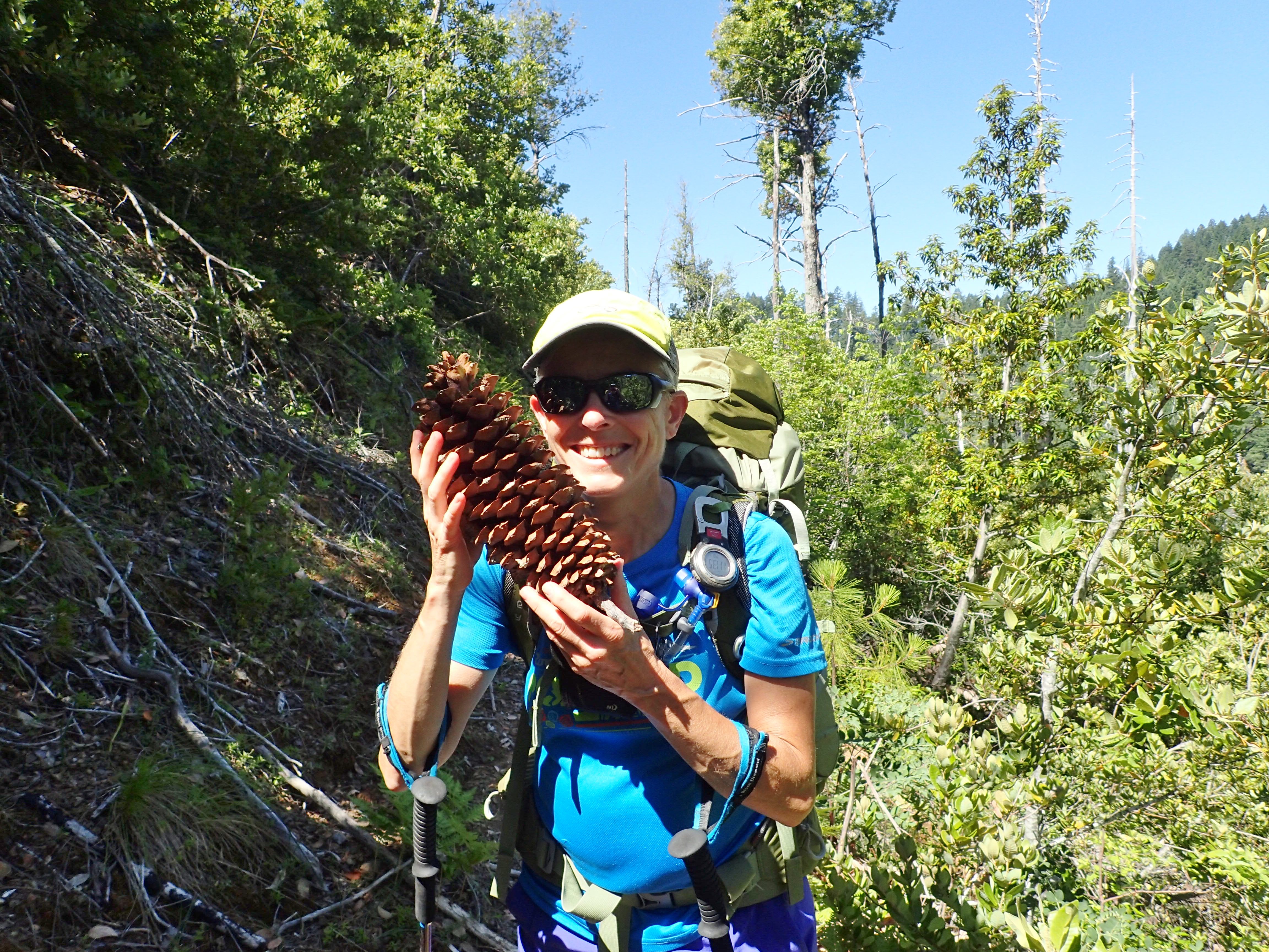
photos and story by Beth Dayton
How had I forgotten the warnings of impenetrable overgrowth, ticks, scarce water, landslides, ridiculous grades, and no escape from the blazing sun?
3 OCTOBER 2017 | AGNESS, ORE. — I’d been reading about the trail for several years and had a masochistic urge to see it for myself. The perfect opportunity came July 4 weekend. I had met Monique Schaefers at a Forest Service Trail Skills College in June and she let it slip that she had done the trail the previous year, and resolved to never, ever, do it again.
Her resolve wavered as we worked our way down my bottle of whisky.
Our plan was to start at Briggs Creek Trailhead and hike west. Our first day took us about seven miles along a rocky slope with wide vistas across the burned-out landscape of the 2002 Biscuit fire, and into a surprise garden of giant Darlingtonia pitcher plants along York Creek.
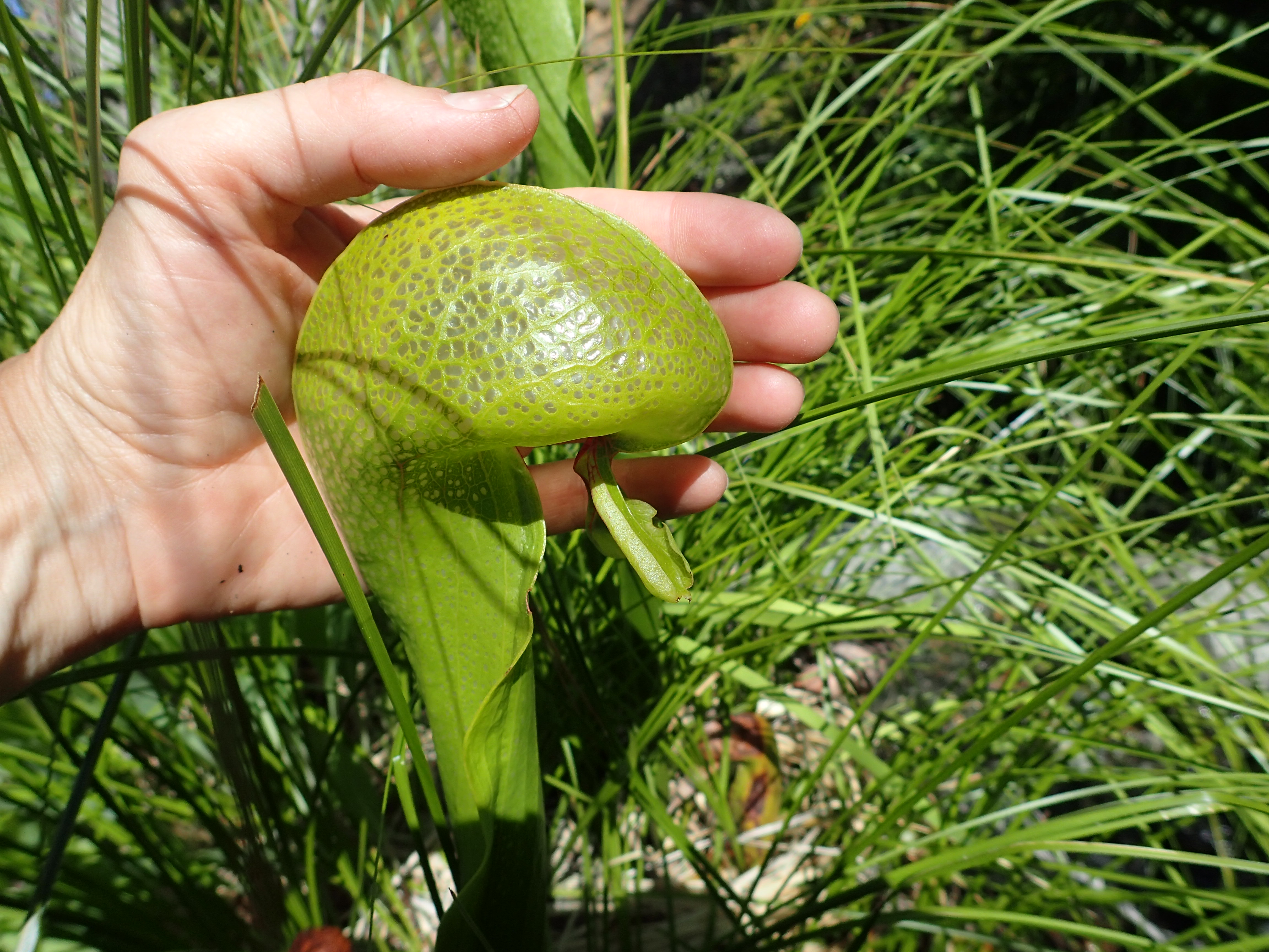 Darlingtonia Californica at York Creek
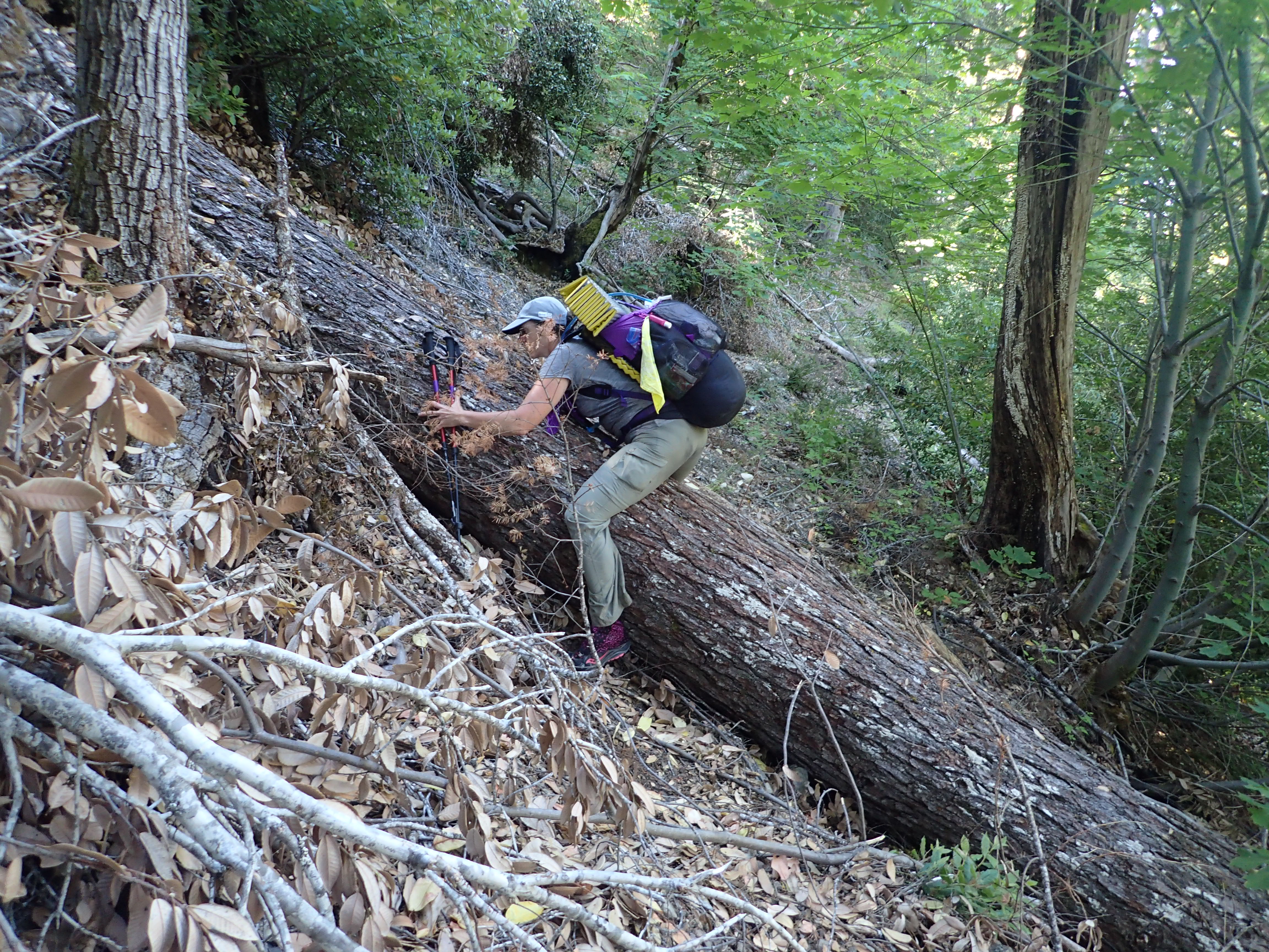
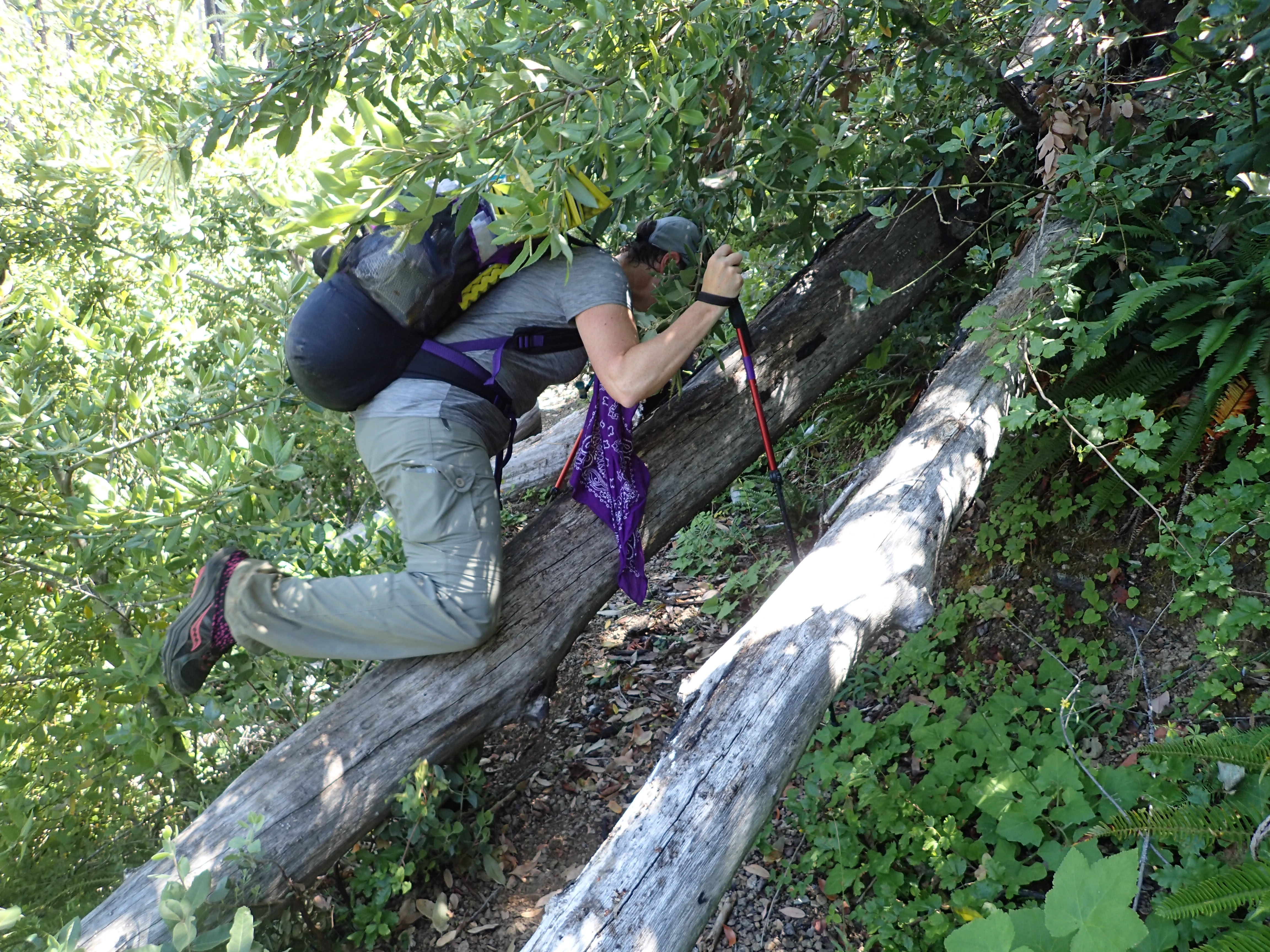
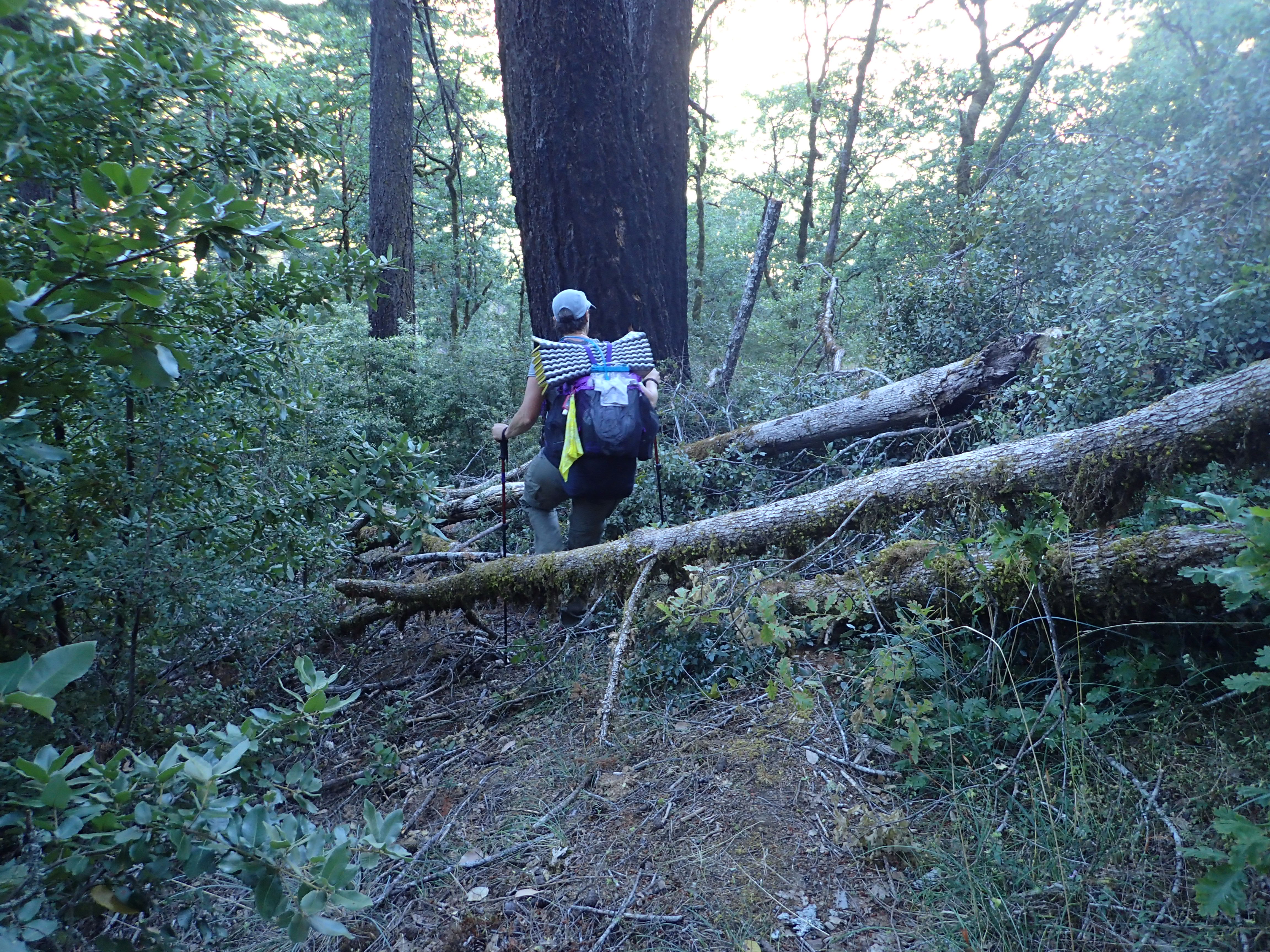
The very steep but well-worn path headed down to a lovely camp at Pine Flat, and beyond that the trail rapidly degenerated into an obstacle course of fallen trees, dense brush and small wash-outs. Multiple times we reduced to crawling on our hands and knees, or balancing several feet above the trail on a jungle gym of branches.
Monique recalled a tiny flat clearing carved out near a branch of Pine Creek for our camp. We had a shallow cool, clear stream for washing and drinking, and of course no sign at all of other people.
Day two brought the trail into the footprint of the Biscuit Fire. Tall black spires of burned out snags punctuated an incredible tangle of saplings and brush, rising 12-15 feet high, and swallowing the trail. For long stretches there was no dirt tread visible at all, only a vague crease in the vegetation to indicate our direction, punctuated by literally hundreds of down logs.
This is tick hell, and we picked dozens of them off of our pants.
Progress slowed to about one mile an hour as the trail traversed toward Bald Mountain. The top of Bald Mountain is one of a handful of green oases here, and strangely enough there is a year-round spring bubbling up into a shallow pool just below the summit. This would be a perfect spot for camp, but we were committed to making more ground and stopped only for lunch.
We filled our waters in preparation to camp somewhere between Bald Mountain and Silver Creek, the next water source. That night we camped at the edge of a grassy meadow, with the green glint of the Illinois River visible far below, a cool breeze, and a silently rising moon.
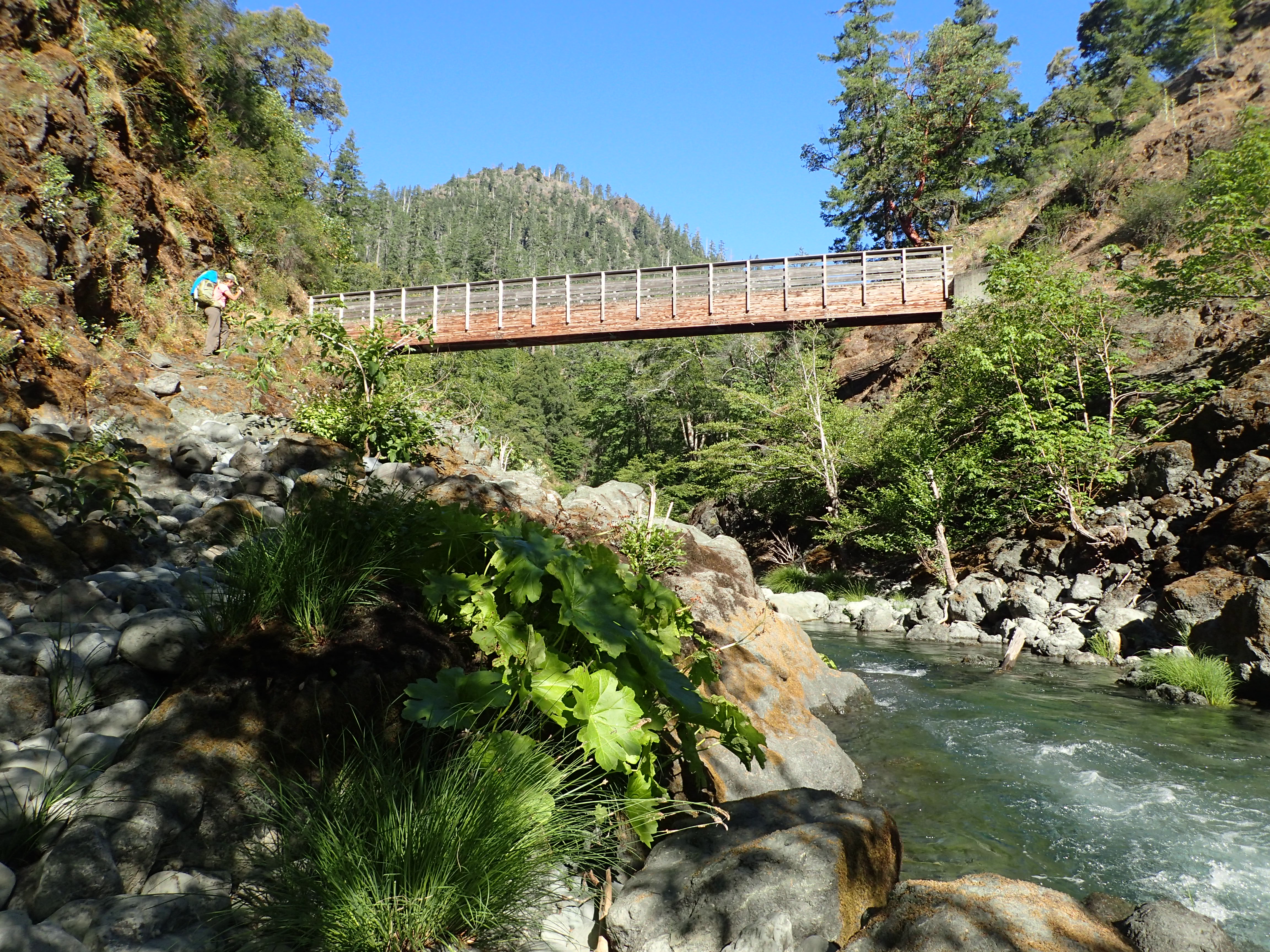
Day three found us thirsty, with just enough water left for a small breakfast and the descent to Silver Creek, which is a wonder of deep green dancing water, inviting a creek-side bath and serious re-hydration. The high wooden bridge that crosses it seems like a mirage in the middle of such a lost trail. There are several inviting sites for a camp, not too far from the creek or the main river.
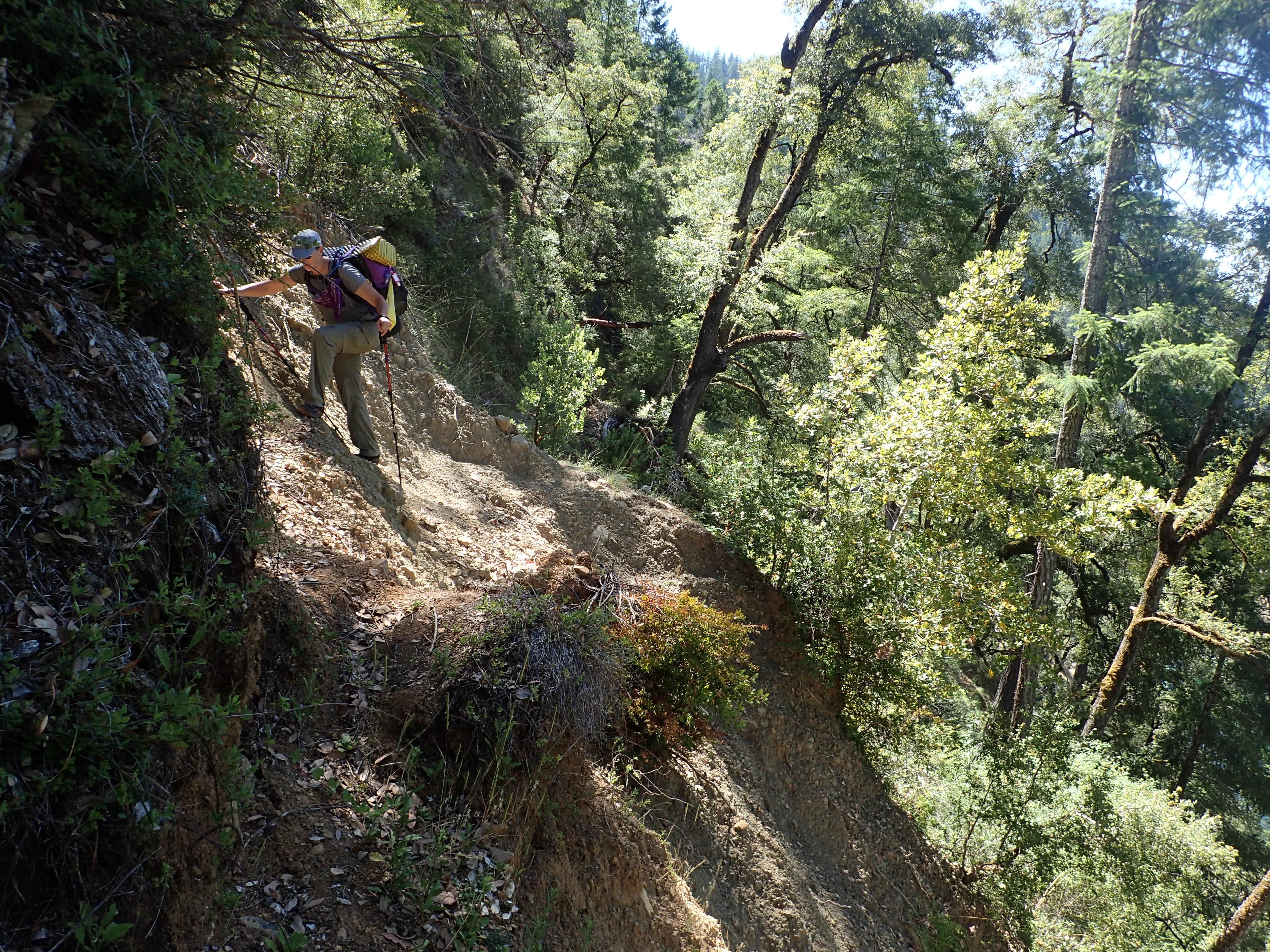
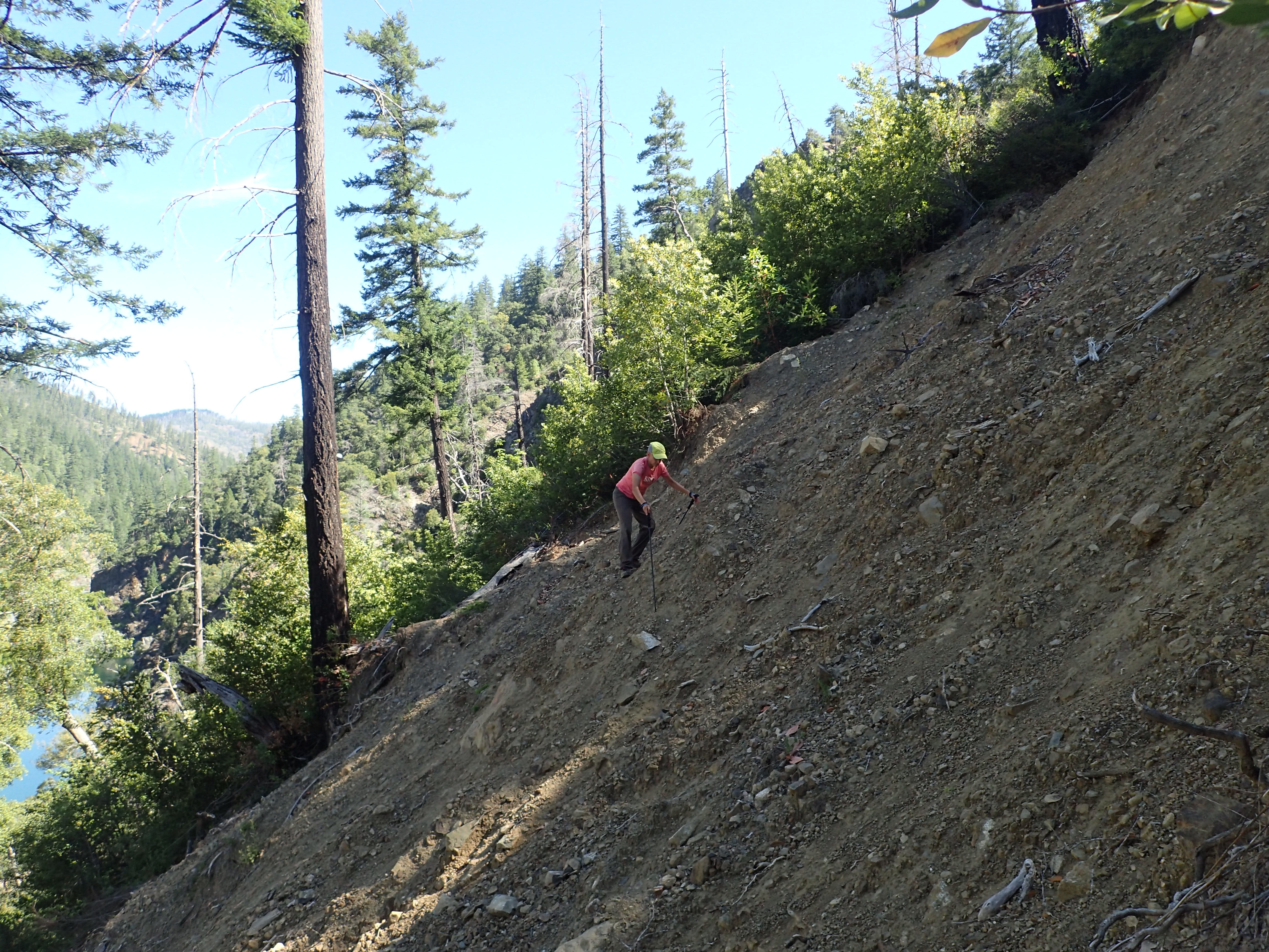
West of the bridge there has been a large landslide of very steep, loose gravel; at the lower edge there is a 10 foot drop-off over a retaining wall which we tried not to look at as we tiptoed across.
Connor’s Camp has several muddy creek crossings and is often listed as a camping spot, but we found it boggy and mosquito infested, so we continued on toward Franz Ranch. We had settled into an afternoon trance of swatting mosquitos, pushing aside poison oak with our trekking poles and climbing under and over logs when we came upon the most serious challenge of the whole trip: A huge landslide had ripped out a full 100 feet of trail and left a nearly-vertical wall of compacted earth with the consistency of concrete, yawning off into a shear drop-off far below.
I was determined to try and cross, but after a strong attempt, I determined it was just too dangerous. Instead, we hauled ourselves hand over hand straight up into the sweltering poison oak infested jungle, barely able to see a few feet ahead, often time suspended above the ground by brush.
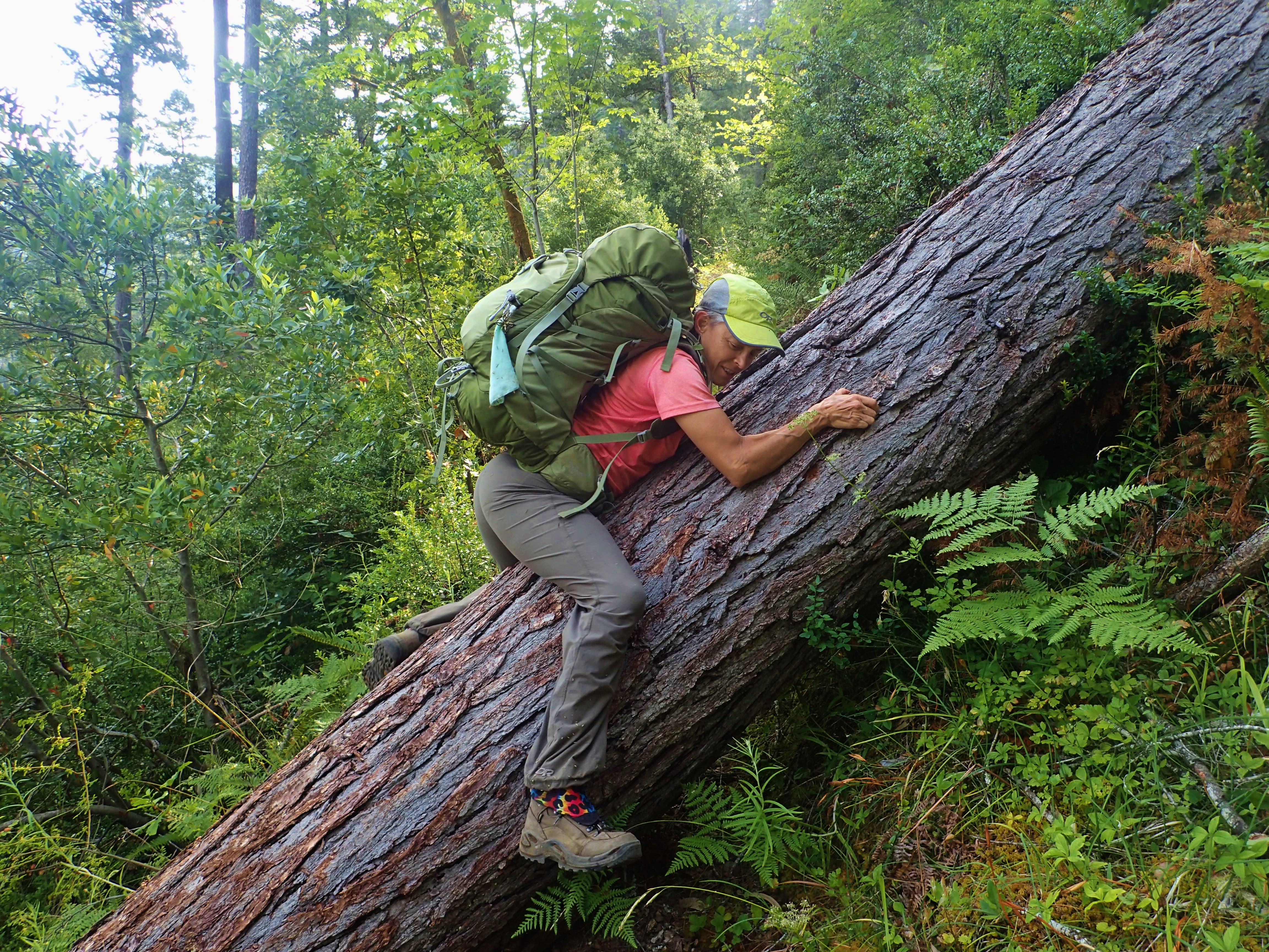
The detour took the better part of an hour and drenched in sweat and poison oak. At Franz Ranch there are some old abandoned buildings, a grassy meadow, and a stream to wash the poison oak oils off in. Our final day was less eventful. Or perhaps we had simply grown used to trail hell. We regularly crossed fallen logs so large that we had to slither over on our bellies, on slopes so steep that we gripped the bark like rock climbers to keep from sliding down like a giant fire pole.
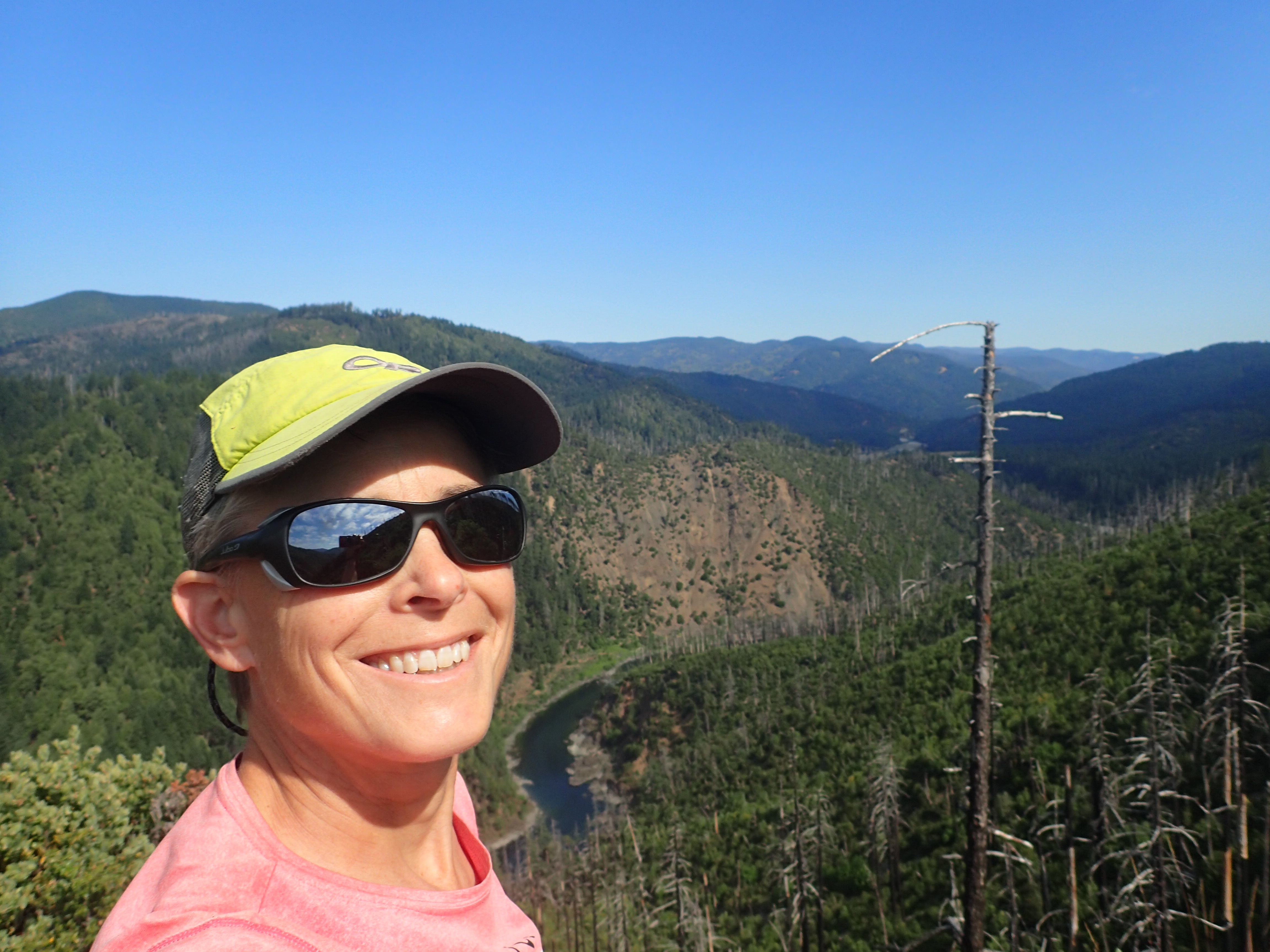
We were rewarded with an amazing view from the top of Buzzard’s Roost, and then a gradual return to civilization—a few trees cleared; an obvious trail bench; mountain bike tire prints in the dust. Once I was sure my car was at the trailhead, Monique and I dropped our gear and plunged into the cool, green waters of the Illinois River and floated there under blue skies for a long, long time.
Beth Dayton lives in Salem, Ore. This trail has been worked on by another organization since her trip.
