for the Siskiyou Hiker
by Gabriel Howe
Join us on Thursday, April 4, 6:30pm at REI Medford (85 Rossanley Drive) for the unveiling of this suite of backwoods maps. Sign up here.
23 MARCH 2019 | ASHLAND, OR. — There is no better tool to get out into and explore the backwoods than a 7.5 minute USGS quadrangle map. Want to find a trail? It’s on there. Want to float a river? Look at the quad. Need to know where the perennial springs are? Need to plan an itinerary with friends or get a feel for how difficult a hike will be? You’re going to want the 7.5 minute quads.

But to explore the Sky Lakes Wilderness, for example, you may have to purchase and tote along seven or eight different quadrangle maps, each at around $10 a pop. And other area map issues are not detailed enough, and have too low a resolution. They omit trails and other important elements.
So a year ago I started looking for solutions. I started playing with ideas to stitch together quadrangles and build cohesive area maps, on a budget. I had the vision of producing the most powerful maps of the backcountry areas we work in.
I got some support from The Carpenter Foundation and Travel Southern Oregon. Then in October or November, I put my staff on it. And now, after months, and hundreds of hours, we have 7.5-minute maps of the Wild Rogue, Red Buttes, and Sky Lakes Wilderness Areas.
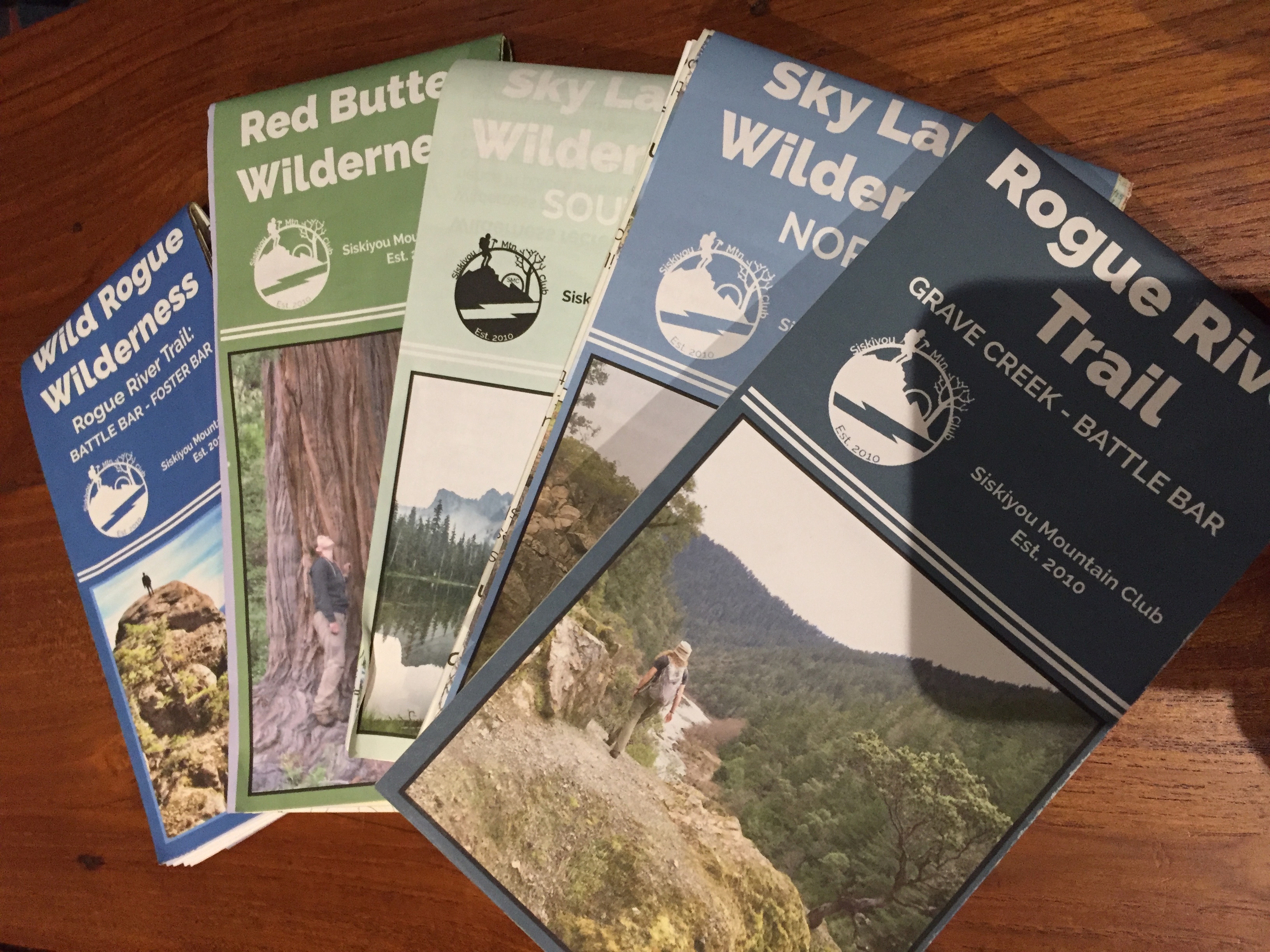
They’re 27 by 36 inches. They include interpretive information and Leave No Trace principles. Our trails are highlighted in a blue hue. These maps are freaking awesome and I love them.
They are what I’ll use in the field. They’ll be what you use in the field. And we’re releasing them on April 4 at REI in Medford, 6:30pm.
We’ll also share more about the maps and how all the work we’ve been doing in the field brought this project on.
I learned how to read maps in the Boy Scouts, where I lasted less than a year. At around age 17 I found myself at Mt. Hood Community College taking a class in Wilderness Survival. It was taught by an instructor Rubenstein.
Well it turns out Rubenstein was dynamite. He took out 7.5-minute USGS quads and brought them to life. Ever since then, maps have really meant a lot to me and have come to play a big part in my life.
They elicit a childlike type of wonder. USGS quadrangle maps let me take stock of the geography. They provide a broader context that no phone or screen ever could.
And I’m excited to share these maps with you on April 4, 6:30pm at Medford REI (85 Rossanley Drive).