
Trans-Kalmiopsis Route: 26 Miles of Mystery, Misery and Bliss
Trip Report by Gabe Howe
In 2006 I started making bids for the upper reaches of Oregon’s Chetco River via trails in the 180,000-acre Kalmiopsis Wilderness. By 2009 I had found Oregon’s largest un-dammed river, but not without crissing and crossing over 1000s of downed logs that were falling from after the 2002 Biscuit Fire.
Shortly after my wife and I foolishly set out to restore a route of eight different trails that form a 26-mile “thru” hike from one end of the Kalmiopsis Wilderness to the other. When we went to work in 2010 we thought it would take one year to clear the route.
Make a tax-deductible donation to help keep the Trans-Kalmiopsis Route open
Five years later Siskiyou Mountain Club volunteers have restored the entire route. People are hiking it. Now it’s your turn.
But before you get started, just a few words of advice after spending little time in the Kalmiopsis Wilderness.
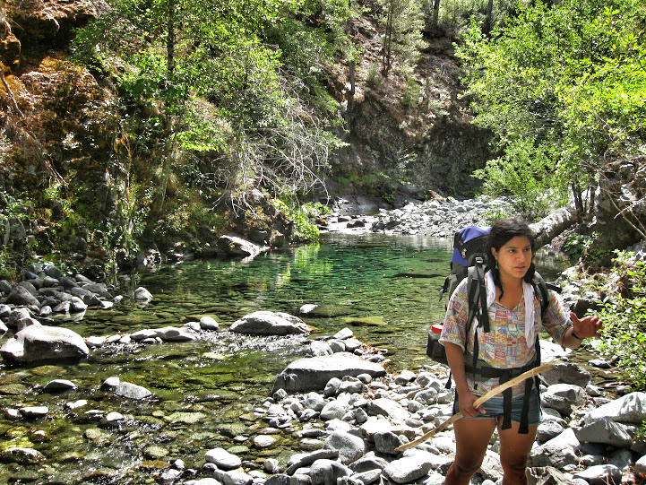
1. Over-prepare and under-pack. Lots of people over load themselves for what is an exceptionally arduous hike and end up ditching their stuff, which then becomes litter.
2. Learn to read a map really well before heading to the Kalmiopsis.
3. Leave no trace. And remember, you’re always being watched in the Kalmiopsis Wilderness Area.
The mileages are estimates and not necessarily accurate. The maps below can be moved by clicking and dragging, zoomed in on, and other layers integrated. Play with the menus and arrows on the top of the screen.
Babyfoot Lake Trailhead to Bailey Cabin: Six Miles or So
[iframe width=’100%’ height=’500′ scroll=’yes’ src=”http://mappingsupport.com/p/gmap4.php?ll=42.211514,-123.830938&z=14&t=t4″]
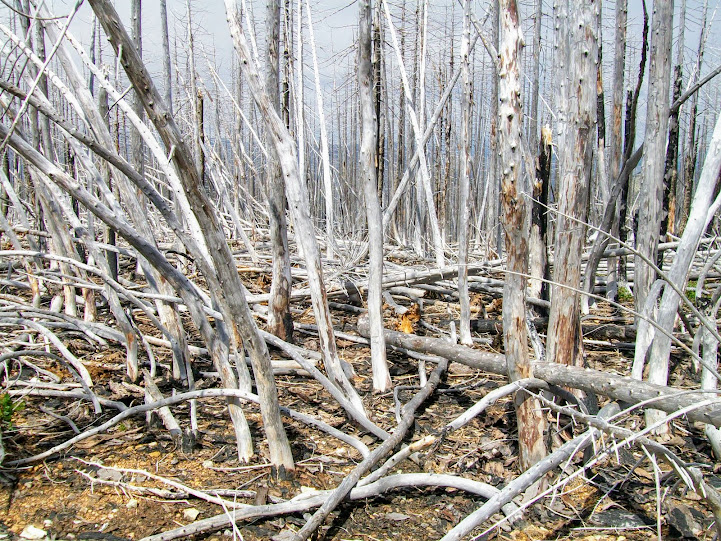
This section is the most bare of the entire route. The Biscuit Fire cooked in this southeastern section of the Kalmiopsis, leaving a 100% crown mortality rate throughout many contiguous acres of forest.
From the Babyfoot Lake Trailhead follow Trail 1124A from the south end of the parking lot. The trail enters a crispy forest and soon reaches a junction. Head left, leaving you on Babyfoot Lake Rim Trail 1126.
1126 heads steeply uphill and climbs close to 800 feet to the rim of Babyfoot Lake, which you may be able to see towards the north along these steep sections. The rocky rim boasts a lot of spring flowers and a skeleton forest that is startlingly beautiful if that’s your thing.
Despite the barren motif the rim of Babyfoot Lake still boasts some Brewer’s Spruce if you look.
Eventually 1126 makes a sharp turn to the west, heading straight down a steep slope and reaches the Kalmiopsis Rim Trail 1124. Head south (left) on it.
This section of the Rim Trail is an old road bed, but is starting to resemble a wilderness trail as logs and brush fill in the old road prism. It gets brushy and each year a number of fire-killed logs from the Biscuit Fire fall over the road.
At around three-miles the trail reaches a big bend and junction with Emily Cabin Trail 1129. This is the only shady section between Babyfoot and Bailey. Just stay on the road bed, heading northwest and follow Emily Cabin Trail along some old mine tailings. Kalmiopsis Rim Trail 1124 heads south here toward Canyon Peak and Cold Springs.

At five miles there is a very easily missed junction with Bailey Cabin Trail 1131. Missing Trail 1131 and following the more obvious path downhill will lead you into the depths of the Little Chetco watershed and eventually, if you make it that far, to an over-developed, quasi-legal mining camp where the modest Emily Camp once stood, homesteaded by Ruth and Perry Davis in years long gone.
Make a tax-deductible donation to help keep the Trans-Kalmiopsis Route open
The road 1129-1131 divide at five-miles is unsigned as of now. Lots of people get lost here. There is also seasonal water near this junction at the apex of this small drainage along Emily Cabin Trail. Get water if it’s available and head uphill and northerly on 1131, toward another old mine area that resembles a martian planet.
After the old road crests it heads southwest and dims to a narrow trail bench. A few sections here are faint, but you can find the way easily. About three-quarters mile from the old mine there is a patch of Kalmiopsis leachiana. At about 6.5-miles from Babyfoot you will reach Bailey Site.
Make a tax-deductible donation to help keep the Trans-Kalmiopsis Route open
The flat grassy area is a decent site for camping, but should be avoided in heavy wind. Widow makers are chalked full throughout old growth fir and pine that burned in 2002. The water at the outlet of the small meadow area is cold and sweet.
Bailey Site to Slide Creek: Around Six Miles
[iframe height=’500′ width=’100%’ scroll=’yes’ src=”http://mappingsupport.com/p/gmap4.php?ll=42.220731,-123.886042&z=14&t=t4″]
Find where the trail entered Bailey Site and head uphill around the rim of this ancient cirque carved out by a melted glacier. Snow still lingers on these north slopes, though not in the last couple of seasons.
The trail will bring you to a ridge where the tread becomes faint, and eventually rises through a few green trees to the base of Bailey Mountain. If you end up staying a night at Bailey, you may consider scrambling the 600 or so feet to the summit of Bailey Mountain.
By the time you’re to the saddle, you’re actually on Bailey Mountain Trail 1109. From here to Carter Creek the trail descends about two-miles and 1,800 feet. This section of 1109 is nasty. It’s narrow and steep. And it’s hot.
Make a tax-deductible donation to help keep the Trans-Kalmiopsis Route open
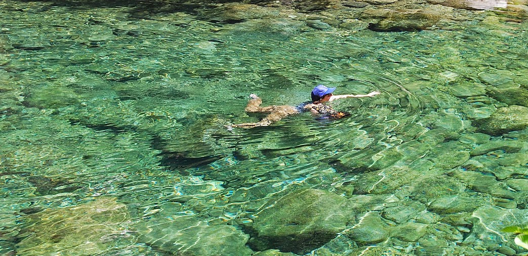
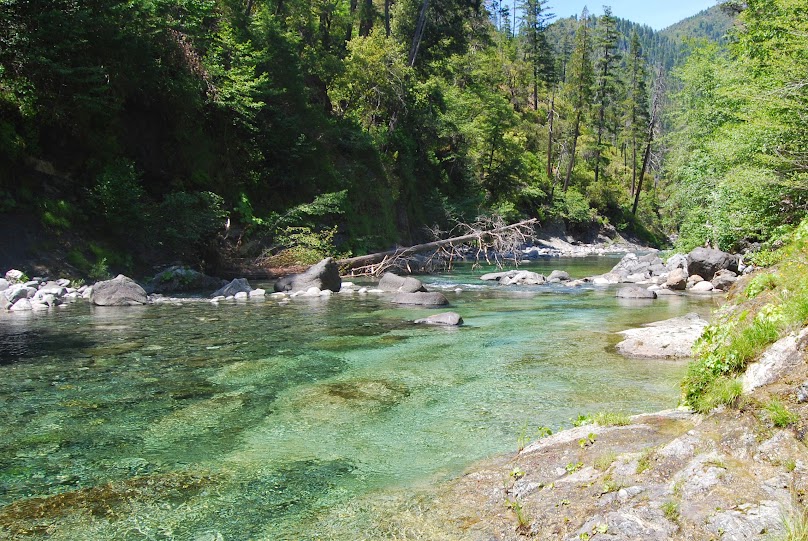
By the time you reach Carter Creek confluence with the Chetco, 9-miles from Babyfoot, you may be ready for a swim. But it’s not the best campsite. The tent sites at Carter are hot, dusty and a steep run from the river.

Cross Carter Creek and head up a steep bank. Here trail 1109 roller coasters along the steep canyon, and before reaching Blake’s Bar lends views of the Magic Canyon. Blake’s Bar is a good camp, especially for small groups or couples. The gravel bar here changes year by year, but usually has a few tent sites nestled adjacent an outstanding swimming hole.
Those eager to explore can swim a few minutes upstream and all the way through the Magic Canyon.

Blake’s Bar also presents the only ford of the Chetco on this route. When the water is high the crossing would be dangerous. When it’s low it’s not more than a rocky hopscotch.
North of Blake’s Bar 1109 gets narrow in places, and eventually breaks into another road bed. Follow it until reaching a small beach just upstream from the confluence of Slide Creek.

This is another outstanding camp with sandy beaches, many tent sites, and a moderate swimming hole.
Slide Creek to Box Canyon: About Four and a Half Miles
[iframe width=’100%’ height=’500′ scroll=’yes’ src=”http://mappingsupport.com/p/gmap4.php?ll=42.260287,-123.894796&z=15&t=t4″]
As you ascend along the east slope across from Slide Creek you’ll find yourself on Upper Chetco Trail 1102, and may or may not see an old sign and recognize different routes down to the river. This trail shows up in an early 20th century USGS release.
Make a tax-deductible donation to help keep the Trans-Kalmiopsis Route open
It climbs steeply, wraps around the slope and assumes a western direction, reaching high above the Chetco River. Eventually it reaches a small plateau where windthrow tends to accumulate, and descends down some switchbacks to a dreamy slope with nice views. And more cold, sweet water.
It traverses through some steep serpentine slopes and eventually reaches an old road bed. Head west, down river. Notice a sign and trail that veers to the left before reaching Taggart’s Bar.
Taggart’s Bar is cream of the crop of the Trans-Kalmiopsis Route. The river channel above and below is outstanding. The camping is comfortably above the river on soft dirt, and later in the year sandy beaches down below.
It’s the most remote camp on the entire route, about 14-miles from Babyfoot and 12 more miles to Vulcan Lake. Upper Chetco Trail 1102 is just southeast of Taggart’s Bar and it ascends about 700 feet to a ridge before dropping down to Box Canyon Creek, another gem.
The best camping at Box Canyon is on the east side of the creek. More outstanding swimming. More beaches.
Box Canyon to Vulcan Lake Trailhead: 10 Miles
[iframe width=’100%’ height=’550′ src=”http://mappingsupport.com/p/gmap4.php?ll=42.258000,-123.942947&z=15&t=t4″]
The sections of Upper Chetco Trail 1102 between Taggart’s Bar and the junction with Johnson Butte Trail 1110 are brutal. They’re a little steeper and longer than the pitches from Babyfoot to Carter, and that’s one of the reasons I prefer approaching the route this direction.
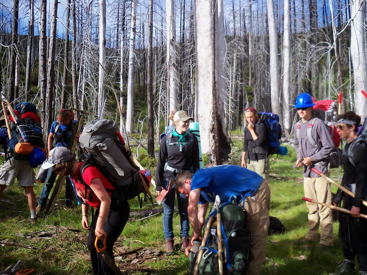
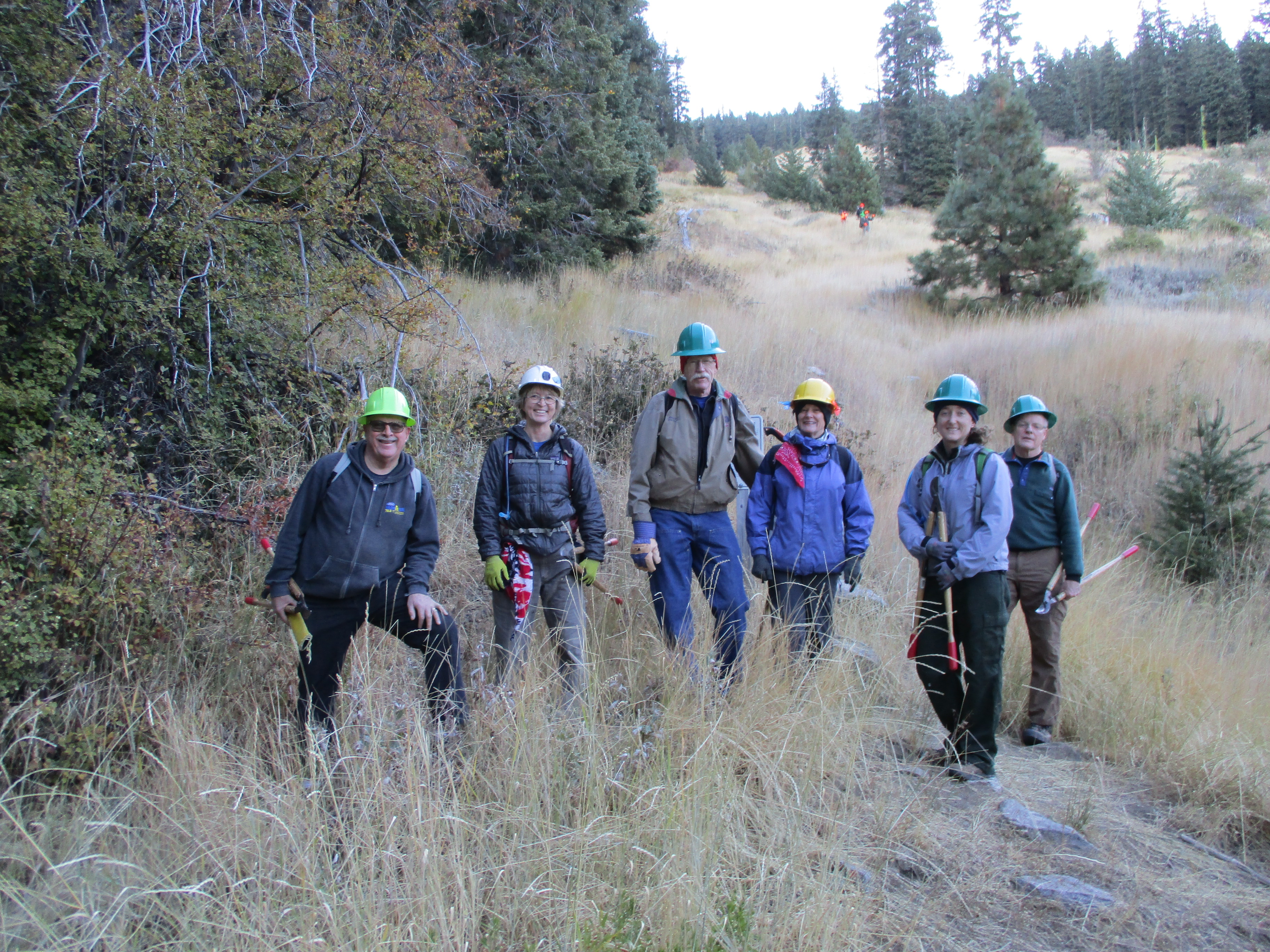
And while these sections of trail are sure to challenge your joints and push your endurance, they’re open (2 September 2014) and clear of jackstrawed trees and brush. Just a couple of years ago these trail sections were impassable and turned hikers around. To pass them you had to take off your pack and crawl and climb over stacks of wood and brush.
The mentioned trail sections have been the hardest to reach, quickest to fill back in with downed trees, most heinous and challenging sections of the Trans-Kalmiopsis Route to restore. And as you walk them notice the stacks of bucked logs resting in peace alongside the trail.
Make a tax-deductible donation to help keep the Trans-Kalmiopsis Route open
There is a faint perennial water supply about half-way between Box Canyon and the Johnson Butte junction with a small pool. It’s not sweet and it’s not that cold either.
After enduring 40% pitches and infinite switchbacks reach junction with Johnson Butte Trail 1110. It heads almost due south through a wooded ravine and reaches a ridge, eventually landing at Johnson’s Hole, a perennial spring about six-miles from the Vulcan Lake Trailhead.

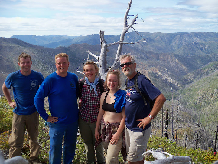
The spring is signed and is a short, steep hike down a spur trail. From here you have nice views of Dry Butte, Chetco Pass, Pearsoll Peak, Gold Basin Butte, Heather Mountain, and as the trail traverses the steep slope views open up of Mislatnah Peak, Quail Praire, Tincup Peak, and other far off peaks.
To me this is among the most scenic sections of the Trans-Kalmiopsis Route, and on clear days you can see the surf of the ocean.
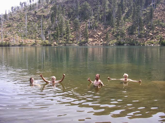
Eventually Trail 1110 reaches a junction with 1910A, and you can make your choice to head towards Gardner Mine and walk a nasty scramble, at least in the dark, over to Vulcan Lake, or hike back to the trailhead. Either way you can find your way go to Vulcan Lake, which is well worth the extra few miles it tacks on.
Make a tax-deductible donation to help keep the Trans-Kalmiopsis Route open

2 thoughts on “Trail Report: Trans-Kalmiopsis Route”
Nice maps.
Thanks for using Gmap4.
Joseph, the Gmap4 guy
thanks alot for all the hard work. i know the country,can be brutal.thanks for the route description,takes some o the guesswork out. i,ve been down towards slide cr,kinda brushy..looks carter cr. the best way to the river.see u there..