
Unfold history with
USGS map locator and downloader
5 June 2015 | Ashland, OR — Studying old maps is like reading old stories, and in the depths of those hand scribbled topos there are narratives found nowhere else. The USGS has made a slew of historic map issues available online, and they’re free to download. They’re in high-resolution PDF format and you can check them out from the leisure of your laptop, or print them at a shop.
Get started at store.usgs.gov, click on the Map Locator and Downloader link, and you’ll be brought to a map of the US. Double click on the map or use +/- buttons on its top left side to zoom into your area of interest:

Once you’re there, click the “Mark Points” bubble to the right of the map. A grid should appear, with a label for each quadrangle. Single click on the area you’re interested in and a teardrop bubble pops up. Click on it.
From there a table will pop up. The most current map issues are at the top of the table. Scroll down to check out older map issues, and click the download link to download the PDFs. From there you can also order maps directly from USGS.
Many of the oldest map issues were 30″. On the right hand side of the map locator, there’s a menu option that lets you select “30 minute and larger.” That will get you access to the oldest quads, like this 1908 issue of the Port Orford 30 minute quadrangle.

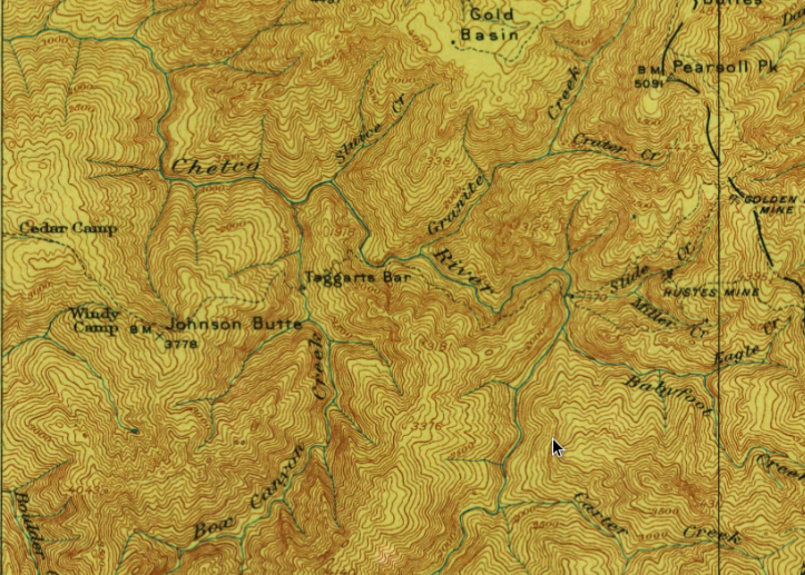
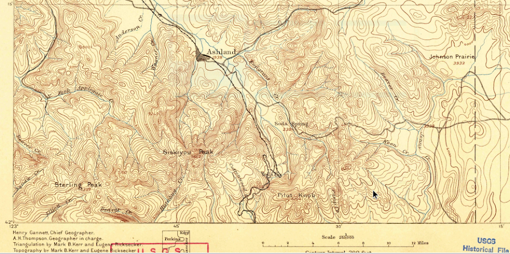
Or this 1897 Ashland quad, when Mt. Ashland was “Siskiyou Peak” and Pilot Rock was labeled as “Pilot Knob.”
1917 issue of the 30 minute Kerby quadrangle:

As you sift through the different quads, you may find it’s easier to get lost in maps than on the ground.
