
After 24 summers on the Wild Rogue:

Loop trail offers fresh eyes
trip report by Gabe Howe
- Download .kml file for the route
- Get the Powers and Gold Beach District Map
- Sign up for an SMC hike
- Check out the interactive map
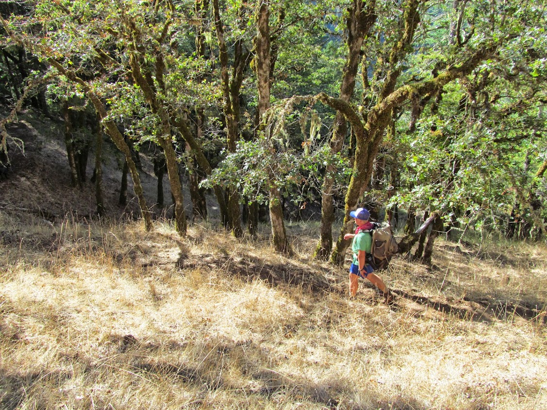
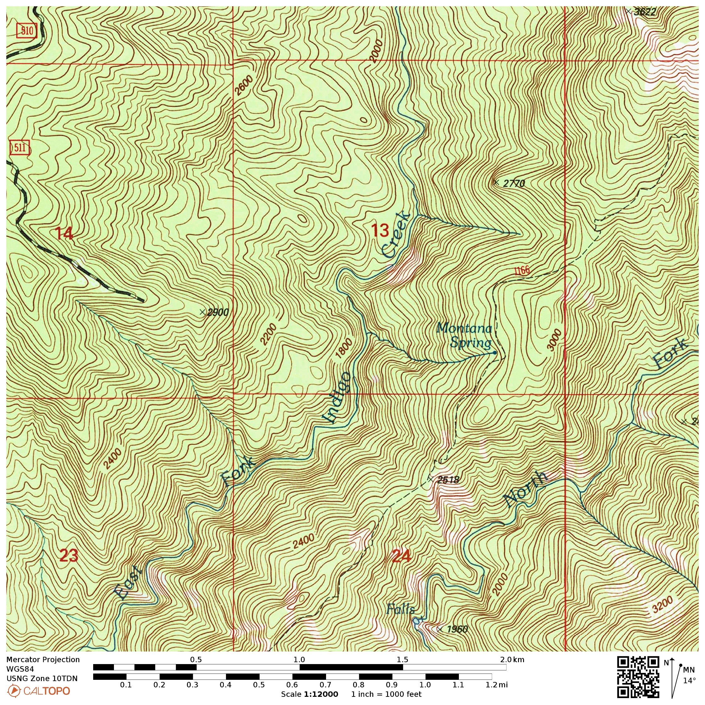
17 September 2015 | Tucker Flat: Wild Rogue Wilderness — We arrive at Tucker Flat Campground (42.721795,-123.877587) at 12:30pm.
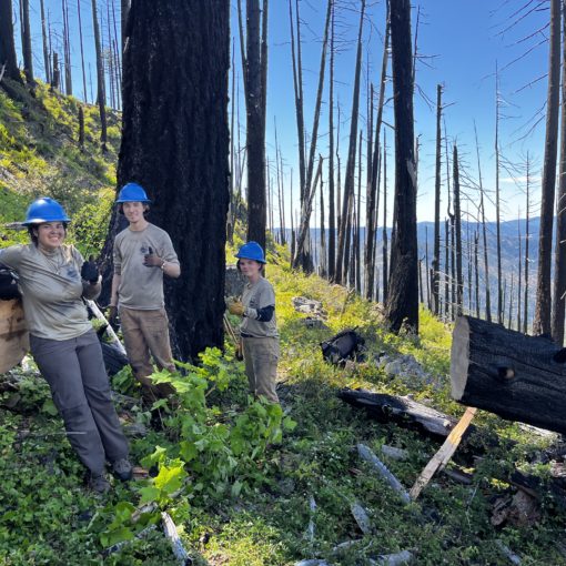
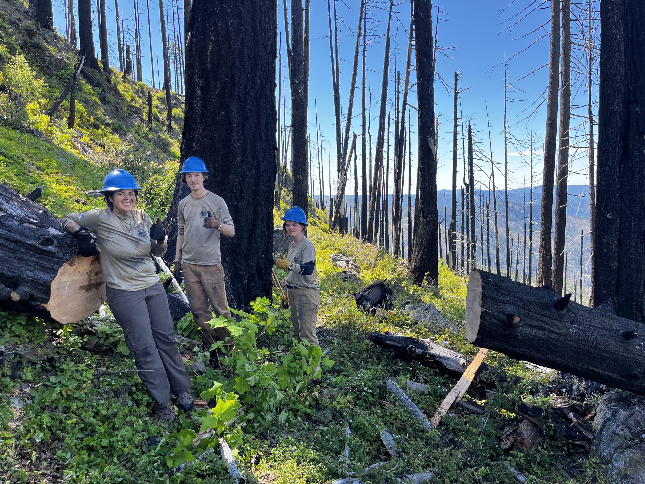
Joining was my office intern, Emily, and it’s her first time backpacking; Angie, a volunteer pushing 150 hours in 2015; and Aaron, my field coordinator who oversaw this project from start to finish.

A few years ago I envisioned restoring a 25 mile loop here. The trails were already there, they’d just been filled in with downed trees. Long trail sections were hard to find, the trail bench was slipping away back into the Wild Rogue Wilderness’s rugged slopes, and nobody had a plan to do anything about it.

By 2015 we secured funding from Medford REI(42.342971,-122.881565) and Oregon State’s Recreational Trails Program to recover this 25 mile backpacking route that features something new with each turn: rugged gorges, primeval forests, broad meadows, and of course, the Wild Rogue River itself. 
Here the West Fork of Mule Creek braids through a narrow gorge, its crystal waters pool up into long trenches, and spill out over little waterfalls into deep gravel beds.
Aaron and his crew restored the entire route this summer.
By 1pm we’re hiking up through his work. The Mule Creek Trail crosses a bridge (42.725893,-123.875141) and winds back down to a wet creek crossing that in high water could be a deal breaker (42.727990,-123.877346). Here the West Fork of Mule Creek braids through a narrow gorge, its crystal waters pool up into long trenches, and spill out over little waterfalls into deep gravel beds.
Just a few months ago this trail section was a tanoak jungle impossible to get through…

The trail goes up and down again to a second creek crossing, then assumes an ascent through mixed forests, along cliffs and along scree slopes. We walk through a section that was impassable before Aaron and his crew came through. Just a few months ago this trail section was a tanoak jungle impossible to get through with a backpack on. Now it looks perfect.
Eventually the trail opened to an old road bed (42.752842,-123.901405) and reaches perennial water around five miles from Tucker Flat (42.767147,-123.912778). That’s where we camp.

18 September 2015 | Mule Creek Headwaters: Wild Rogue Wilderness — We start hiking up the old road by 9am and reach the Buck Point Trailhead (42.755899,-123.931961). From there we ascend on Panther Ridge Trail 1253 through untouched forests and take a side hike to Hanging Rock (42.740677,-123.930244).

After a quick break at Hanging Rock, we continue southwest on 1253, which roller coasters its way through more primeval forests.

By about 2pm we reach the Clay Hill Trail (42.699595,-123.988867) and take a last break before the day’s last, steep descent.

….the trees are at battle. Slowly the spindly firs are encroaching on mixed hardwood forests that were, I sense, once preserved by fire.
1160A has graceful, wide switchbacks deliberately laid by thoughtful trail engineers. But it doesn’t come without some steep pitches. That’s okay because there are lots of reasons to slow down and stop.

The old growth is astounding on the trail’s upper reaches. Lower down, the trees are at battle. Slowly the spindly firs are encroaching on mixed hardwood forests that were, I sense, once preserved by fire. The oaks, madrone, tanoak and chinquapin reach up with sparse branches for sunlight, but their effort seems futile.
It looks like without fire, this mixed forest will become dominated by Douglas fir.

This is mid September on a mid slope in the Wild Rogue: divine.
We reach the old Thomas Homestead (42.676220,-123.979897), the first water source since this morning at Mule Creek’s headwaters. The battle of tree species goes on here, and all around it you can see young fir trees creeping into the meadow. They’ve already taken over entire acres of a large bench.

The wind blows around on this bar just about 1 mile and 1000 ft above the river, rippling and whipping the golden grasses. This is mid September on a mid slope in the Wild Rogue: divine. Fill your water and enjoy.

19 September 2015 | Clay Hill: Wild Rogue Wilderness — First we take a side hike to look at some big trees.
I started rafting the lower Rogue over 24 years ago this month.
The trail down from the homestead is a series of long switchbacks through a steep meadow.

All the trees lean downhill, like the entire hill is slowly being pulled down. It winds through an oak savanna, into more old growth, and down to the Rogue River Trail (42.669594,-123.977768).
We’re there by 10am.
We only have a few miles to our destination upstream, so I hike slowly and let myself wander from the group. I started rafting the lower Rogue over 24 years ago this month. As a boy I’d look up from a raft into these steep, rugged mountains and wonder what was up there.

Eventually I got the chance to satiate the wonder, but it feels comforting to be back on the lower Rogue canyon.

Tate Creek, Brushy Bar, Blossom Bar, Clay Hill, Half Moon Bar, Zane Grey’s Cabin — they are placemarks in my childhood adventures.
Suddenly I find myself at Half Moon Bar (42.693760,-123.943264). Swim time. Angie and I head down and splash in the water for a couple of hours, and meet some BLM and Forest Service employees on a joint trip to patrol the river.

These places — Tate Creek, Brushy Bar, Blossom Bar, Clay Hill, Half Moon Bar, Zane Grey’s Cabin — they are placemarks in my childhood. It feels like home to be back on the river.
We reach Blossom Bar (42.703727,-123.918244) and setup camp. This is the first site with a bear box and a bear hoist to secure food. Just a couple of miles from the trailhead, it feels a little silly to stop.

20 September 2015 | Blossom Bar: Wild Rogue Wilderness — It may have felt silly to stop, but the stars were amazing and in the early morning they started bursting into flames. Well worth it.
Mule Creek Canyon is always dramatic, and a hell of a way to end the Wild Rogue Loop

And so is the hike from Blossom Bar upstream. Mule Creek Canyon (42.699311,-123.898616) is always dramatic, and a hell of a way to end the Wild Rogue Loop.

It all looks the same as it ever did, but coming from the loop gives me fresh eyes.

This route opens up a lot of possibilities. With more than three trailheads and two connections with the Rogue River Trail, trail users can pursue longer backpacks or shorter day hikes through the Wild Rogue. Hikers could incorporate lodge stays and raft support to lighten their load and throw in a little luxury. River users may consider making the one mile climb from Clay Hill for views of that dreamy meadow.
But I prefer it in four days from my backpack.
Questions about the Wild Rogue Loop? Call 541-708-2056 or email info@siskiyoumountainclub.org
This project was fully supported by REI Medford and Oregon State’s Recreational Trails Program.

14 thoughts on “Trip Report: Wild Rogue”
I backpack with a few men every year and we decided we should checkout the Rogue. This Wild Rogue Loop looks good. Any options to extend it to a longer loop? What is the optimal time of year to do it?
You can extend the loop by hiking a longer section of the Rogue River Trail. Shoulder seasons are best as the loop’s upper reaches (Hanging Rock is about 4000′) can be snowed in, and smoking hot in the summer.
Planning on doing the Wild Rogue Loop on May 1. Will be driving down from the north on I-5, what trailhead do you recommend?
Hi Greg! We recommend hiking the loop counter-clockwise from Tucker Flat Campground. Happy trails.
Is the loop currently hike-able?
Yes it is.
Still planning on hiking the loop around May 1. I hear that the Poison Oak is a problem. I was hoping to bring my dog but poison oak and ticks might create a dog problem. Any feedback?
My wife and I hiked it last weekend. No issue with ticks but we have treated all of our gear. Poison oak is heavy up to 2000 to 2500 feet. Water is an issue on top. One small source that I don’t think will be running very long. We did get to watch steelhead in Mule Creek.
Just completed the loop starting from Foster Bar which sure did add some miles. Absolutely an awesome trail but there are issues. I can’t imagine doing this loop past June with heat and water issues. I will do a complete post with plenty of photos soon.
Here is my trip report post for the Wild Rogue Loop May 1-4.
https://higheredtechtalk.org/2016/05/07/wild-rogue-loop
Thinking to hike the loop this week with my dog. What is the availability of water?
I’m driving out to Tucker Flat in 1 hour. I’m camping there and starting the loop tomorrow morning. I will comment again when I get back.
-There is no such thing as bad weather, just the wrong clothing.
Finally home! I ended doing the loop CLOCKWISE! Kicked my booty! Absolutely amazing! I can’t wait to get back up there this spring. The creek crossings are no joke at this time of year. Glad to be home and dry.
would i be able to do this trip in the first week of January?